

Versatile Integrations
DJI Enterprise UAV Integrations

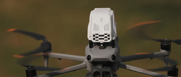
With DJI Matrice 4D / 4TD & Dock 3
With DJI Matrice
4E / 4T / 30 / 30T

With DJI Matrice 400
(Up to 2 Sniffer4D Nano 2 Plus)

Real-Time Data Display & System Control via DJI Pilot App

Real-Time Data Display & System Control via DJI FlightHub 2
From UAVs in the air, to robot dogs on the ground, and vehicles on the road
Other Integration Options

Robot Dog

Ground Vehicle
Available Parameters

Recommended Configurations:
Ambient air monitoring 1: PM 1.0 & 2.5 & 10 + O3 + NO2 + CO + TVOC
Ambient air monitoring 2: PM 1.0 & 2.5 & 10 + O3 + NO2 + CO + SO2
Sniffer4D Nano 2 Plus Multi-Gas
5 internal slots available for mounting sensing modules of your choice (see below).


Sniffer4D Nano 2 Plus Methane
With Multi-Pass TDLAS technology for methane-only sniffing detection
Linear Range: 0~11,000 ppm
Limit of Detection: 200 ppb (3x typical baseline noise 60 ppb at stable temperature)
Display Resolution: 100 ppb
Recommended Applications:
Natural Gas Plant / Landfill Routine CH4 Rough Survey
(check for overall concentration anomalies then use MetScan for precise localization)

External Measurement Modules (For Matrice 400 Integration Only)

Output & Deliverables
Data Visualization
Try interacting with a small subset of AIRINS.ai's visual functionalities below: click and drag to explore 2D / 3D views, scroll to zoom, and use the icons to switch between Point Cloud, Grid, and Interpolation heatmaps to see the gas concentration distribution.
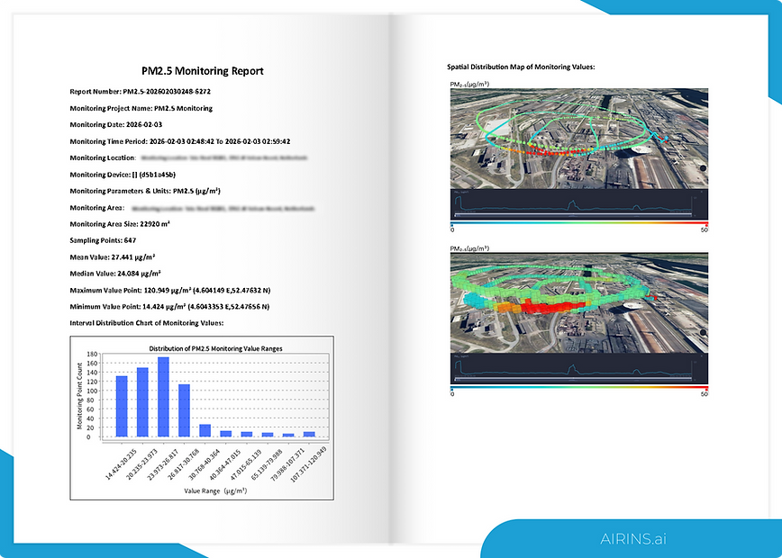
Generated Report
AIRINS.ai turns each mission into a structured, actionable report. It summarizes the mission time period, location, area, and concentration information, providing interval and spatial concentration distribution at ppm levels.
Reports can be exported as PDF or editable DOCX for sharing and follow-up.
Other Outputs
AIRINS.ai supports GIS-ready exports, including shapefiles (.shp) and structured data (.json) for integration into existing mapping and asset systems. For internal analysis, users can also export tabular data (.csv) to support review and recordkeeping across missions, and generate animated playback of screening results for briefings and discussions.
CSV
GeoJSON
Shapefile
Animations
Case Studies
Submit an Evaluation Request
Product Information
Email:

Answer in ~60 seconds. We will recommend the most appropriate configuration.